EARTH SIGNAL PROCESSING LTD
Calgary, Alberta, Canada
EARTH SIGNAL PROCESSING LTD
!
The Largest Dedicated Onshore Seismic Processing Company in the World.
About EARTH SIGNAL PROCESSING LTD
Established in 1993, Earth Signal Processing specializes in onshore, high-resolution 2D and 3D seismic data processing.
Earth Signal has become an industry leader in seismic data processing. We work with hundreds of clients in the Western Canadian Sedimentary Basin and around the world.
At Earth Signal, our professionals use sound geophysical methods, attention to detail, proven, robust proprietary software and prompt service to provide our clients with accurate, consistent onshore seismic solutions. Since 1993 thousands of wells have validated our seismic sections and we are privileged that many of our clients have been with us since the beginning.
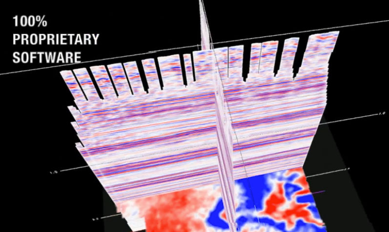
Creating a 100% proprietary processing system has been a conscious choice from the inception of the company. We believe this is where true quality control really begins, and allows us to respond to the needs of our clients in the timeliest fashion.
Seismic data processing at Earth Signal is a team effort and as such our entire team will be able to contribute when their experience and knowledge is required. When you hire Earth Signal Processing, you hire the knowledge base of the entire company. One of the strengths of Earth Signal is to make the process and workflow as interactive between the processing team and the client as desired. There will be a dedicated processor assigned to manage your project from start to finish and beyond, while being aided by the entire group.
Mission Statement
Earth Signal Processing Ltd. will provide our clients with consistent global seismic solutions on time through sound professional geophysical practice and friendly service.
Description of Services
Our Services:
In business since 1993, Earth Signal specializes in onshore high-resolution 2D and 3D seismic data processing. Our highly talented Processing Geophysicists and 100% proprietary software allow us to provide accurate, consistent solutions with very fast turnaround times.
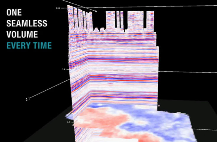
No project is too large or too small. Whether it is a single 2D line or a large 3D merge project, we have the people, software and hardware to provide the best possible product. Our largest 3D merge to date consists of 117 individual 3Ds, 375,000 shot records and 7,000,000 bins all merged into one seamless volume.
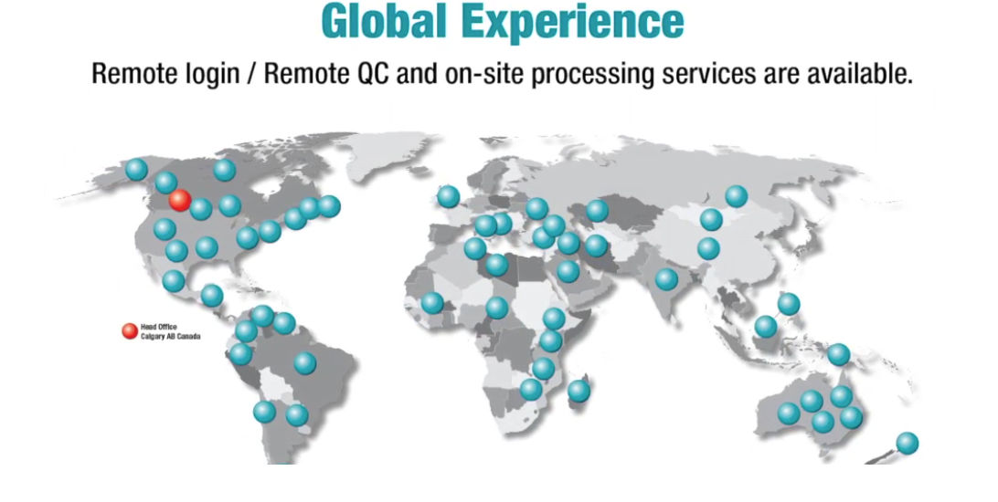
Our international processing expertise is vast. We have successfully processed data from basins all over the world and can provide on-site processing services for our clients.
Earth Signal employs a team of Research and Development staff to create and continuously improve our processing software. As our clients needs change, we are able to provide them with the tools they need to get the most out of their data.
Flexible, fast, custom solutions are what we pride ourselves on. Let us show you how to get the most out of your data. Please contact us to learn more.
Our Services Include:
1). Dedicated Onshore Processing
Earth Signal is the largest dedicated onshore processing company in the world.
Earth Signal has focused all our efforts to onshore seismic data. For over 25 years, we have created unique solutions for processing land seismic surveys. We have developed various statics solutions, velocity analysis tools, noise attenuation algorithms and geometry confirmation displays for the delivery of an accurate final image of the subsurface. We feel strongly that this focus and experience working with onshore seismic data ranging from high-resolution stratigraphic targets to complex thrust-belt data around the globe gives us a unique advantage. Seismic data processing at Earth Signal is a team effort. Rather than having separate, geographically specific groups, our entire team will be able to contribute when their experience and knowledge is required. When you hire Earth Signal, you hire the significant knowledge base of the entire company.
2). 100% Proprietary SeisRight™ Software
Since 1993 every algorithm from geometry assignment to final output has been written by Earth Signal.
Our Software is 100% written, maintained and upgraded internally, not having to wait for upgrades or bug fixes from commercial software vendors. In an industry of complex imaging, explorationists need a processing company capable of sound research and development. We can provide a knowledgeable, unique look at your data and can respond and adapt to your requests and real world challenges. Allan Bradshaw, P. Geoph., our R&D Director has refined a set of programming rules which are followed for all software development at Earth Signal. This strict adherence to writing code ensures that our software continues to move forward efficiently and effectively, and allows our team to provide results that are understandable and consistently accurate.
3). 2D/3D Processing
Earth Signal processes all sizes and types of 2D and 3D projects.
One of our latest projects included over 600 lines with various vintages from 1985 to 2005. We were chosen for this project due to proprietary tools such as our 2D tie program which ensures consistent phase and statics along with our innovative 2D noise attenuation programs. In the 3D world we also cover the gamut of varying challenges, sizes and complexity. We use our proprietary 3D software tools for interactive geometry assignment, QC and first break analysis. We try several refraction statics techniques and the best solution is the starting point for our Refraction Tomography iterations. Our velocity analysis tools include an anisotropy correction and we incorporate the well log data as a guide for geologically sensible final velocity models. Our unique 3D noise attenuation techniques ensure AVO compliance. We are onshore seismic processing experts and we excel at solving these issues. All this is accomplished with no third party software for a truly unique look at your data.
4). 3D Pre-Stack Merge
Earth Signal has earned the reputation as “The 3D Merge Experts” primarily due to the sheer number of merges we do year over year.
Three proprietary techniques we use to ensure a seamless pre-stack merge include 3D Rank, an assignment of a unique identifier to allow prioritization of preferential data quality, Unique Noise Attenuation and Overlap Analysis QC. Our largest merge to date involved one hundred separate 3Ds, all with different sources, patch sizes, and orientations. We also pride ourselves on incorporating 2D lines to 3D seismic surveys, and we ensure the 2D lines are processed with an equivalent flow to tie your 3D data seamlessly. This is particularly useful when incorporating wells that fall on a 2D line extending into the 3D area.
5). 3C Multicomponent Processing
A natural progression from our P-wave processing is the most recent addition to our SeisRight™ toolbox; 3C processing including shear wave splitting analysis.
By ensuring some important items such as correct geophone rotation, polarization filtering for ground roll, ACP gathering and later CCP gathering and event registration, we ensure accurate and reliable PS-wave processing. We remove the effects of shear wave splitting in the zone of interest by solving for multi-layer differential anisotropy. After the anisotropy has been removed, the energy found on the transverse component due to shear wave splitting is added to the radial component. This not only results in improvement in stack quality, but also in determining orientations and magnitudes of anisotropy for each of the analyzed layers.
6). 5D Interpolation
Earth Signal uses a Minimum Weighted Norm algorithm for our proprietary 5D Interpolation.
This is a subsurface consistent interpolation computed from Inline, Cross-line, Offset, Azimuth and Time dimensions which results in fully regularized CMP gathers for further processing. Our interpolation is AVO friendly, and preserves azimuthal anisotropy changes. We also have the option to interpolate using a Cartesian coordinate system using the COV method rather than Polar coordinate system used in the subsurface approach.
7). 4D Time Lapse Processing
The back bone of proper 4D processing revolves around geometry reconciliation.
At Earth Signal we reconcile the monitor and baseline surveys in receiver line, receiver station, shot line, shot station, elevation, and recording patches. During reconciliation, different station skid allowances are tested to see the resulting CMP fold outputs. Without proper fold and geometry reconciliation, differences between the stacks cannot necessarily be attributed to 4D time-lapse effects. Therefore, to achieve consistent 4D responses, the baseline and monitor surveys need to have 4D geometry reconciliation applied every time a new survey is acquired. Our iterative NRMS Amplitude QC measures the repeatability of the traces between the baseline and monitor. RMS amplitudes can be sensitive to phase, static and amplitude differences so it is important to run NRMS QC’s after every process to make sure we are not introducing a time lapse response that is due to a processing artifact. Low NRMS values indicate high repeatability between surveys.
8). Carbon Capture Imaging
Specialized all-inclusive state-of-the-art workflows available for CCS projects
Seismic datasets are one of several Geophysical techniques commonly being utilized throughout the life cycle of Carbon captures, utilization, and storage (CCUS) projects worldwide.
2D/3D seismic datasets allow for initial large scale subsurface geological assessment and feasibility for potential CO2 CCS sequestration sites. During injection, 4D time-lapse seismic is a valuable method for monitoring the CO2 sequestration process.
Over the past ten years our seismic imaging expertise has been utilized on many acclaimed and internationally recognized CO2 sequestration projects, including projects in Western Canada, United States and Australia. For example, over the past five years we have been acutely involved in the Weyburn-Midale Carbon Dioxide project, the World’s largest carbon capture and storage project. Our experience in this field has led to the development of specialized all-inclusive state-of-the-art seismic data processing workflows applicable to these CCS projects including:
- Seismic acquisition design and parameter verification
- Multi-dimensional 2D/3D well guided seismic processing workflows
- 4D Time Lapse Monitoring
- Multi-Component (Converted Wave) workflows
- Fracture characterization via specialized azimuthal analysis
- AVO Inversion (PP or joint PP/PS) generating rock property attributes for QI work
9). Anisotropic Pre-stack Time Migration (PSTM)
We use noise attenuated, 5D regularized gathers with extended maximum offset for further AVO analysis as input to our PSTM.
Within our interactive velocity analysis tools we include an option to correct the far offsets in the presence of anisotropy. The correction values, which may vary in time and space, are used in our Kirchhoff pre-stack migration.
10). Pre-Stack Depth Migration
Through our recent acquisition of Data Modeling Inc. (DMI), a Calgary based seismic imaging company, we have extended our advanced imaging toolbox to include proprietary pre-stack Depth (PreSDM) migration workflows utilizing AutoImager.
The acquisition agreement is exclusive and includes all intellectual property, software, code, and experienced imaging personnel including the original founder. Since 1996, DMI has spent over 60-man years developing proprietary velocity analysis and imaging tools known in the industry as AutoImager. Having the opportunity to augment our leading toolbox with robust depth migration software with proven results, and experienced depth migration personnel, allows us to offer our clients an expanded package of advanced complex imaging solutions.
AutoImager has successfully completed over 550 projects. These include 2D and 3D data, land and marine, and PreSTM and PreSDM from around the globe:
-Imaging Issues Addressed by AutoImager
- Salt Flanks
- Sub basalt events
- Steeply dipping structures
- Highly faulted structures
- Sub chalk events
- Fault Shadow problem
- Poor signal to noise
- Extreme velocity variations
- Detailed interval velocity
- Pore pressure prediction
11). Complex Structural Processing
At Earth Signal we have a suite of programs that are specifically written to handle challenging and highly structured data.
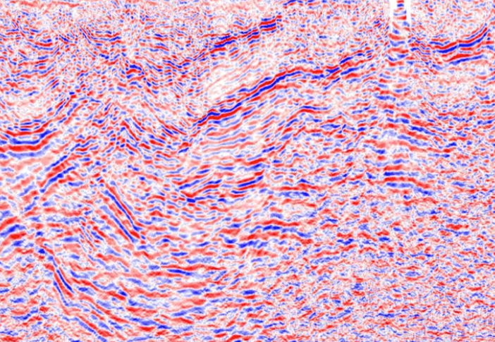
We have extensive experience with challenging noise contamination and maintain the relative amplitudes of the data for further AVO work. We use techniques such as our Genetic Statics algorithm and our unique and innovative Noise Attenuation programs to enhance data in structurally complex areas. It is important to correct for anisotropy during the velocity analysis. These anisotropy values will later be used in the PSTM, extending the maximum usable offsets for better imaging. The velocities are re-picked after the PSTM as data in highly structured areas will change after PSTM. We then re-run the PSTM with the new velocities, and iterate the residual velocity analysis.
12). AVO Compliant Processing
Maintaining surface consistency in processes such as deconvolution and amplitude scaling is crucial for relative amplitude preservation.
Our AVO compliant flow includes multiple passes of surface consistent amplitude scalar computations after each pass of noise attenuation. Our deconvolution is a 5 term frequency domain surface consistent decon. We refrain from using any trace by trace process. Our noise attenuation techniques and 5D-interpolation programs are all AVO compliant.
13). Gather Conditioning for AVO Analysis
Earth Signal uses trusted workflows and algorithms to prepare gathers for AVO Inversion work.
Using coherent and random noise attenuation, we use trusted workflows and algorithms to prepare gathers for AVO Inversion work, and to help predict pore pressure. Honoring amplitude and phase, increasing signal to noise ratio, and correcting residual moveout are all crucial to help enhance AVO Inversion success. Trim statics, NMO de-stretching, and multiple attenuation are part of the suite of programs we have written to condition the gathers for AVO analysis.
14). Simultaneous AVO Inversion
Using a model based approach we begin by creating P, S, and density models with horizons as a guide.
Once we convert to angle gathers, we then process the CDP gathers through 5D interpolation and PSTM. Angle gathers are analyzed at well locations to determine the variations. A wavelet is extracted from the data and phase corrections are applied to each angle stack, then a spatially variant wavelet is extracted after final rotation. Background trends, angle stacks, models and extracted wavelets are then input into the inversion algorithm. The outputs provided by our method are, P-Impedance, S-Impedance, Vp/Vs, Poisson’s Ratio, Lambda Rho, MuRho and Density volumes. QC of the results are done in conjunction with client representatives using our interactive software where we can crossplot the wells, seismic, wells vs seismic, and view the model, result and the residual.
15). P-Wave Azimuthal Anisotropy Analysis - VVAZ/AVAZ
For wide azimuth 3D surveys, we can analyze the behavior of velocities and amplitudes and equate those observations to azimuthal anisotropy.
With our 100% proprietary software, we can interactively measure the magnitude of the different velocity variations and the fast and slow directions of the velocities. These values can be displayed as a vector at each 3D bin to make up a horizon display of fracture density and orientation. Our interactive software can analyze these variations at each bin and display several QCs to ensure that the sinusoidal behavior is captured properly and the azimuthal corrections are applied. We can perform this analysis at a horizon of interest that has been picked by the interpreter. We then produce the vector map for the entire surface. The vectors are shown at each bin and the colour changes indicate the magnitude of the velocity differences or fracture intensity. Likewise, we can analyze the behaviour of amplitudes with changing azimuths to quantify the azimuthal anisotropy effect.
16). Attributes
Earth Signal has the ability to produce over 30 different attribute volumes as part of our deliverables including various volume, horizon, trace and inversion attributes.


What we do
Our Technology
Since 1993 Earth Signal has developed our own 100% proprietary SeisRight™ processing software suite. Our main focus during the development of our software has been to create innovative algorithms and unique workflows allowing us to provide our customers with the highest quality products.
We currently employ a team of full time R&D and Programming staff who are continuously developing and maintaining our software based on client and market input. This allows us to be extremely flexible and responsive and not dependent on a third party provider for software fixes or updates.
We exclusively process onshore seismic data, and with that focus have created specialized solutions for land seismic survey issues such as statics, velocity analysis, noise attenuation and geometry confirmation. We have developed advanced tools such as 5D pre-stack interpolation, azimuthal anisotropy detection from p-wave data, 4D processing of time-lapse surveys for reservoir monitoring, pre-stack simultaneous AVO inversion, and a full suite of 3C processing capabilities.
Because of our dedicated onshore focus, our proprietary software, and our international processing experience, Earth Signal has become a preferred service provider for many companies around the globe. We use web-based tools for our clients to remotely QC their projects from overseas. The centralized processing centre with readily scalable online disk space, along with our collaborative team-based company structure gives us a significant advantage over our competitors in terms of turnaround time and data quality for processing projects.
Earth Signal maintains a centralized, scalable, state of the art hardware infrastructure with enough capacity to handle multiple large projects simultaneously with over 3,800 CPU’s, multiple HPC clusters, back up centre and various media loading, plotting and secure FTP server.