Fairfield Geotechnologies
Fairfield Geotechnologies
!
Provider of high-resolution multi-client seismic data and mapping services.
$600/hr
About Fairfield Geotechnologies
Privately held Fairfield Geotechnologies is a leading provider of high-resolution multi-client seismic data and mapping services in the United States. Combining market-leading subsurface reflectivity and signal imaging techniques with strategic partnerships, Fairfield Geotechnologies delivers a superior seismic data solution for developmental exploitation.
Description of Services
- Multi-client seismic data mapping is a powerful tool advancing energy industries' net-zero ambitions. By gathering high-quality seismic data at regional scales available for long-term license, we prevent unnecessary duplication of effort and provide E&P operations with superior subsurface imaging at early-stage development.
- With fewer trucks in the field, lessened operational hours, and fewer disruptions to environmental sensitivities – Fairfield Geotechnologies works side by side with suppliers and vendors who have developed strong, transparent ESG policies to design solutions and strategies our workforce can use to create positive sustainable circumstances for net-zero, real-zero initiatives, and reduced emissions.
- This model allows access to all operators large and small to state-of-the-art 3D seismic data and services, assuring efficiencies in the development of assets through the entire lifecycle.

What we do
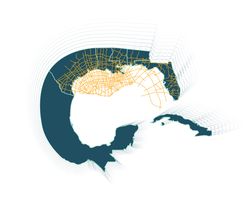
Fairfield Geotechnologies has subsurface 3D survey where you need it. Covering all major onshore U.S. basins and the Gulf of Mexico, let Fairfield Geotechnologies help you visualize fine-scale geology and robust geophysical attributes at regional and prospect level scales. Contact one of our Sales Representative today to schedule a QC.

Life at Fairfield Geotechnologies
1974
Fairfield Industries was founded.
1976
Fairfield Industries began its first 2D transition zone seismic program in Louisiana.
1989
Fairfield Industries introduces their first, non-exclusive 3D seismic survey in the US GOM. This marks the beginning of a 20-year seismic acquisition campaign which resulted in total coverage of 22,375 square miles of contiguous multi-client data in the shelf Gulf of Mexico.
2005
Fairfield Industries launches the ZNodal system, the first cable-free nodal seismic system for both land and water environments.
2010
Fairfield Industries was renamed FairfieldNodal, to reflect the teams’ expertise in nodal technology. FairfieldNodal pioneered the use of ocean bottom nodes (OBN) worldwide.
2012
FairfieldNodal expands its multi-client presence to the Permian Basin with the acquisition of the first nodal multi-client program in the Delaware Basin. An acquisition campaign that continued uninterruptedly to 2020 dba Fairfield Geotechnologies – adding over 6,000 square miles of high-end seismic coverage in the region.
2014
FairfieldNodal commences the first multi-client OBN survey on the shelf GOM. The Ogo FAN acquisition, a 136-block full-azimuth nodal survey in the Eugene Island protraction area, GoM.
2018
FairfieldNodal acquires Geokinetics U.S. multi-client data library expanding its onshore multi-client library to over 10,000 sq mi in key U.S. basins, including Appalachian and Powder River basins. FairfieldNodal changes its name to Fairfield Geotechnologies to reflect Fairfield’s strategy and continuing evolution as a provider of life-of-field technologies, data, and solutions. Fairfield Geotechnologies divests of its Acquisition and Equipment divisions to Magseis Fairfield to focus its operations on the multi-client data licensing business.
2019
Fairfield Geotechnologies launches the next generation of high-resolution onshore multi-client seismic in the U.S. – The C-Ranch/Mud City multi-client survey in the Permian Basin.
2022
Fairfield Geotechnologies acquires Ion Geophysical Inc. U.S. multi-client data library adding over 19,000 linear miles of Gulf SPAN and Florida SPAN data and expanding its onshore multi-client library to over 16,000 sq mi in key U.S. basins including Appalachian and Anadarko becoming the largest modern 3D data provider in the Delaware, Appalachian, and Niobrara basins.


