


esri
Redlands, California, United States
esri
!


Where mapping meets AI. Organizations are integrating location analytics and machine learning to fuel innovation, make predictions, and accelerate real-time insight.
About esri
We make the world's most powerful GIS software. Esri builds ArcGIS, the world’s leading GIS mapping software.
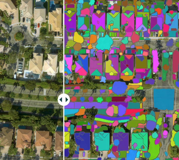
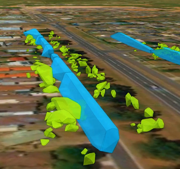
Esri is the global market leader in geographic information system (GIS) software, location intelligence, and mapping.
Since 1969, we have supported customers with geographic science and geospatial analytics, what we call The Science of Where.
We take a geographic approach to problem-solving, brought to life by modern, enterprise-grade GIS technology. We are committed to using science and technology to build a sustainable world.
Description of Services
Where it all began
In the 1960s, Jack and Laura Dangermond envisioned technology that could help decision-makers balance human development with environmental stewardship. Laura was a social scientist interested in rational thinking and analysis; Jack was a landscape architect who learned entrepreneurship and customer care from his family's business.
While Jack attended Harvard, they both worked in the university's Lab for Computer Graphics and Spatial Analysis, where early mapmaking software was being developed. Inspired by the technology's potential, they conceptualized using computer-powered mapping and analysis for complex problem-solving. In 1969, they cofounded Esri, known then as Environmental Systems Research Institute, Inc. (ESRI), in their hometown of Redlands, California.
Esri initially focused on performing environmental studies for land-use planning projects. Laura ran company operations, and Jack quickly gained a reputation as a pioneer in digital mapping, helping develop some of the first tools for digitizing maps, computer mapmaking, and spatial analysis, as well as the first commercial geographic information system (GIS). Continuous innovation, investment in research and development, and a genuine customer-centric philosophy helped Esri evolve into the world leader in GIS software, now an essential tool across the private, public, and nonprofit sectors.
Esri's vision remains the same today as it was for Laura and Jack in the beginning. Technology, science, and a geographic approach can be used by business and government leaders to make better decisions—building sustainable prosperity while safeguarding the planet on which we all depend.

What we do
Support your mission with location intelligence
Esri Services is a global network of GIS experts who provide professional, training, and support services. We're here to help ensure that location intelligence is supporting your mission—the cornerstone of the work that you do. We are problem solvers, listeners, facilitators, guides, and trusted advisers to thousands of ArcGIS users. Benefit from our experience of working together with organizations like yours, our extensive network of industry and technology experts, and our direct access to the latest innovations in Esri technology.
Who uses Esri technology?
Leading organizations in virtually every field use Esri technology to support daily operations and guide long-term strategies. Explore stories of organizations innovating with ArcGIS.
-
Leverage your technology
The systems you use directly impact the efficiency and quality of your work. Do more with your existing Esri technology or acquire additional solutions to optimize your configuration and effectively harness the content and capabilities of your systems.
-
Empower your people
Equip your workforce with the skills needed to get the most out of Esri technology and gain a competitive edge. Increase confidence within your teams and inspire trust with stakeholders by validating skills.
-
Enable your organization
Increase the benefits of location intelligence across your organization. Strategically apply ArcGIS capabilities to existing processes and systems and to the parts of your organization that are not leveraging GIS.
-
Support your mission
Identify the most impactful uses of GIS that support your mission and achieve outcomes that positively affect your bottom line.


Life at esri
Options built for you
Esri Services provides defined service offerings to fit common needs as well as customized services to address unique requirements. Whether supporting a small project or applying GIS across your organization, we work with you to better understand your goals. Our experts and consultants can help implement the best GIS approach for you by applying proven methods to understand, plan, and act based on your needs, getting you access to optimal specialists at the scale and time frame that best suits you.