

Flyscan
Kingwood, TX, USA
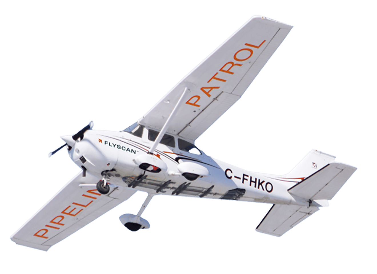
Flyscan
!


Integrity – Above and Around the Pipeline.
About Flyscan
Midstream and Upstream Pipeline Operators
We are your trustworthy wingman for the integrity of your right-of-ways. Detect and act on risks that keep you awake at night.
Transform your traditional ROW patrol into a high-value multi-service platform.
Flyscan is a rapidly growing company in critical infrastructure remote sensing and automated inspection with the drive and agility of a start up.
Description of Services
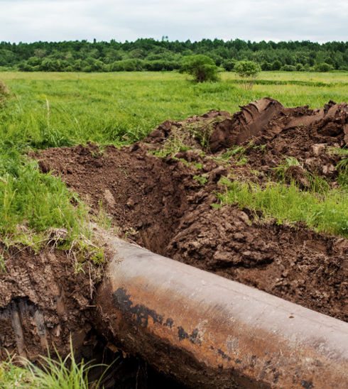
a) Leaks
We developed the world’s first product that detects small liquid leaks from a patrol plane.
Our state-of-the-art product can detect seeper liquid leaks at the stage they’re still too small to be seen by human observers. We can prevent major environmental damages and remediation costs.
Automated hyperspectral detection
Technology that sees beyond the visible. It is often said that two sets of eyes are better than one. But what about eyes that would allow you to see the invisible?
Key features:
- Hyperspectral technology allows rapid detection of real soil contamination by hydrocarbons
- Customizable reports and alerts for optimal monitoring tailored to your corporate practices
- Easy consultation of detection reports and data via a web portal
- Meets inspection requirements for hazardous liquids [49 CFR § 195.412(a)] and natural gas transmission (49 CFR § 192.705)
- Detect spills as small as 10 ft2 / 1 m2
- Compatible with most helicopters and aerial inspection aircrafts (Cessna 172/182/206) that use Meeker Mounts
- Can be used by your current aerial inspection provider or provided to you as a service with our aviation partners.
Advantages and benefits:
- High sensitivity, reliability, accuracy, and robustness (very low false alarm rate)
- Fast response time, as early as 24 hours from receipt of data
- Cost effective offering with unbeatable business case
- Reduces pipeline downtime and remediation costs by acting earlier
- Photogrammetric and hyperspectral recording of the right-of-way allows post-flight examination and proof of compliance for auditing and reporting
- Shared right-of-ways can be surveyed only once, thus sharing costs between stakeholders
- Facilitates and reduces the costs of ESG reporting
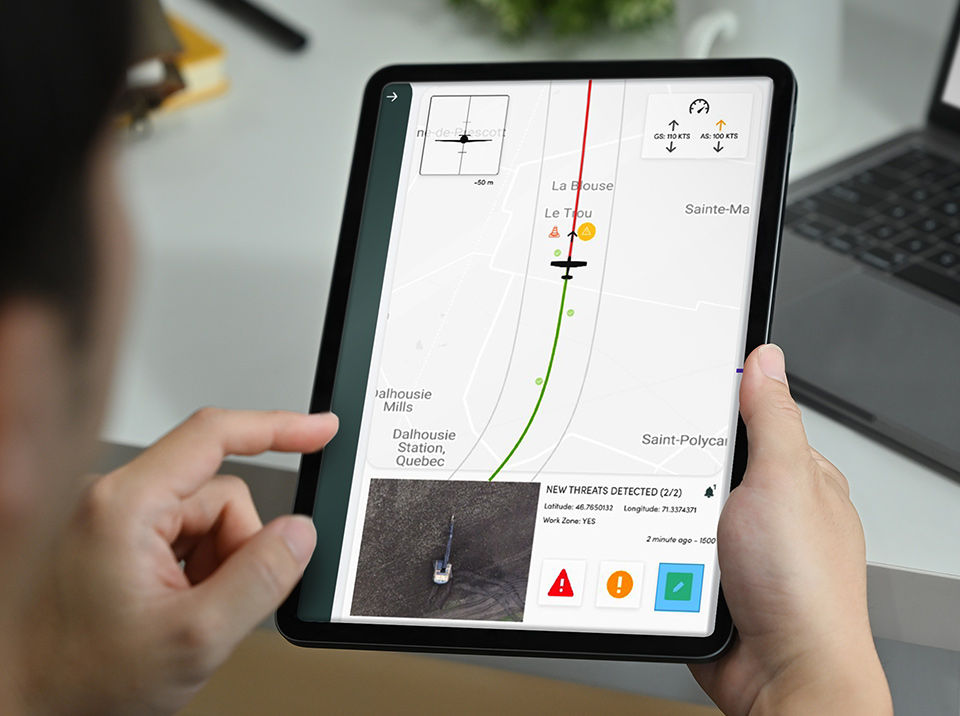
b) Threats
Real-time alerts to intercept threats.
Our AI-based product is the only one in North America that detects threats in real time and notifies your team via text messaging and email. We offer a seamless integration with your ticketing system to make detections actionable by your field teams.
Key features:
- Detects threats in real time using artificial intelligence (email and text message notifications)
- Integration with existing ticketing systems
- Allows access to detection reports and data via a portal (simple, user-friendly interface)
- Provides high-resolution georeferenced images of your right‑of‑ways, send your teams to the right place at the right time
- Allows simultaneous inspection of shared right‑of‑ways
- Compatible with most helicopters and aerial inspection aircraft (Cessna 172/182/206)
- Can be used by your current aerial inspection provider.
Advantages and benefits:
- The pilot’s attention is not divided between the high-risks of flying, low-altitude flying and the inspection of the right‑of‑way
- Use of artificial intelligence improves the consistency and quality of detection, and reduces the “human error” factor
- System performance does not degrade over time during long missions (observer fatigue)
- Installation of equipment on existing air patrols reduces costs and facilitates technology implementation
- Instant availability of critical information to control centers and field teams
- Online portal reports ensure traceability between inspections
- Photogrammetric recording of the right-of-way enables post-flight review and proof of compliance
- Shared right-of-ways can be surveyed only once, sharing costs between stakeholders
c) Geohazards
Mission-critical data, for sound decision-making.
- Vegetation management
Our photogrammetry technology allows us to quickly identify natural features that can threaten the operation and maintenance of your pipelines, such as:
- vegetation cover that visually obstructs aerial surveys;
- shrubbery and trees;
- a right-of-way management tool;
- maintenance planning.
Advantages and benefits:
- Quickly identify areas requiring maintenance.
- Deploy teams on the ground only where needed to minimize travel and costs.
- See obstructions for the entire pipeline at a glance.
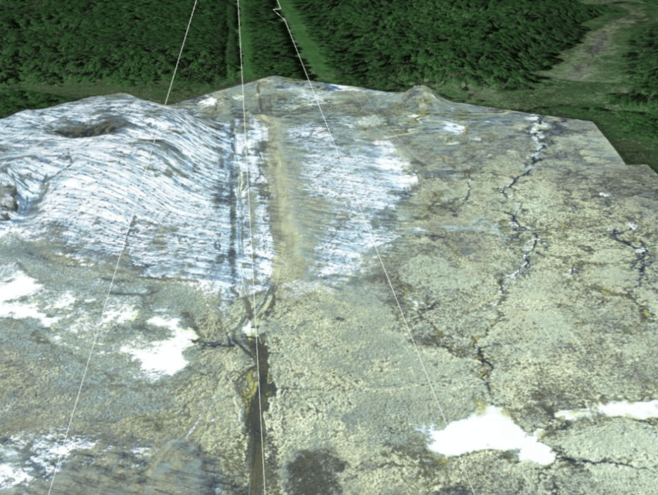
- Geohazards evaluation
Spot-check monitoring is not always enough!
Geohazards, hydrotechnical hazards and erosion hazards have two things in common:
- they can be observed at different scales (from less than a foot to several hundred feet);
- they can develop over short or long periods of time.
Advantages and benefits:
- Cover more than 1,500 feet in width and hundreds of miles in length, in a single day.
- Detect elevation changes over time.
- Assess terrain stability and erosion.
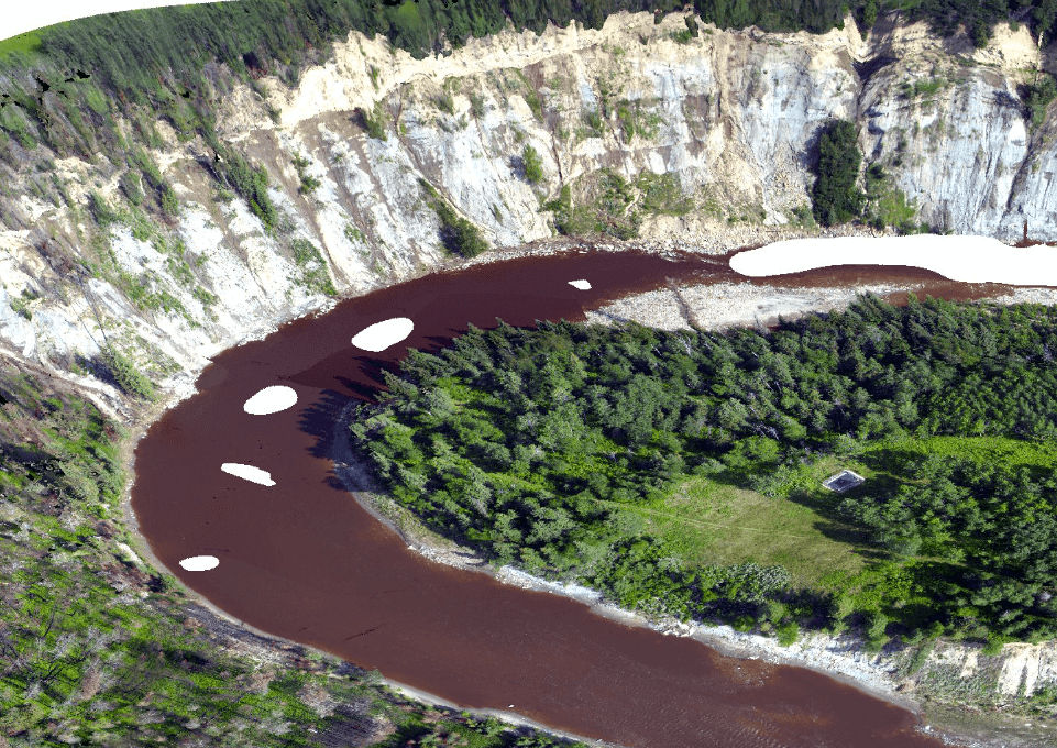
- Hydrotechnics and erosion
Water, like geotechnical processes, can have an impact on pipeline routes and right‑of‑ways.
Our technology easily reveals:
- fine channel deviations;
- bank erosion;
- seasonal erosion.
Advantages and benefits:
- Detect changes in topography and watercourses.
- Inspect infrastructure after catastrophic events.
- Reveal river clogging by landslides or debris.

- Depth-of-cover
Given all the natural processes and human actions that can occur in the vicinity of a right‑of‑way, the thickness of the soil covering a pipeline is exposed to a number of risks.
We provide you with accurate aerial topographic surveys that include this critical data.
Advantages and benefits:
- Detect the depth of pipeline coverage over several miles of detailed imagery with a resolution of 6 inches.
- Assess changes over time.
- Identify problem areas.
- Save time and money.

- Change and anomaly mapping
We automatically monitor changes in coverage and topography, such as:
- brush clearing;
- infrastructure damage;
- construction or demolition of building;
- natural disasters (fire, flood, etc.).
Advantages and benefits:
- Keep track of changes.
- Anticipate future changes.
d) Geospatial
Extract critical
geospatial data.
Save massive recurring costs.
- Surveillance that goes far beyond what the naked eye can see!
Flyscan goes beyond leak and threat detection, taking monitoring to early warning and risk prevention.
Our trio of state-of-the-art photogrammetric cameras, featuring automated image processing, produces:
- orthomosaics (precise location);
- detailed topographic data sets (surface and terrain models);
- Coloured 3D point clouds.
All this information is analyzed and made available to you via our Geographic Information System (GIS), soon available online!
- Terrain Dynamics and Ecosystem Insights
Our high-resolution topographic products (digital surface model or terrain) offer optimum accuracy and enable geohazard assessment along the easement or pipeline.
Advantages and benefits:
- Provide immediate risk indicators, such as a critical slope leading to a landslide.
- Detect topographical changes (displacements or changes in terrain).
- Reveal an evolving situation (slope creep).
Integrate these early warnings into the geography of your pipeline route!
- GIS : Your decision-making partner
All geospatial layers are referenced for addition to Geographic Information Systems (GIS) so that they can form an integral part of your decision‑making processes.
A more detailed analysis, such as the risks associated with rivers, roads and level crossings (in compliance with regulations), can also be carried out.
What we do
A clear vision of the future
In 10 years’ time, the energy infrastructures and utilities of the entire world will be inspected automatically from the air, using phenomenally accurate sensors and software.
Pilots and employees will be out of harm’s way. Ecological disasters will be avoided. And the critical assets of energy companies will be protected by technologies that are never tired, consistent and reliable.
And then we’ll be the undisputed market leaders!