

Geometrics Inc
San Jose, California, United States
Geometrics Inc
!


Empowering geoscientists everywhere to explore and quantify the world since 1969
About Geometrics Inc
Empowering geoscientists everywhere to explore and quantify the world since 1969. For fifty years, Geometrics has pursued its mission to explore and understand the land, sea, and air using geophysical methods, and it’s accomplished this through constant cutting-edge geophysical research, innovative equipment manufacturing, and world-class customer support. Explore the Earth's surface for minerals, oil & gas, unexploded ordinance, and utilities, or conduct geotechnical engineering studies, archaeological surveys, and more with our innovative line of seismographs, magnetometers, and geoelectric instruments. Geometrics has provided superior equipment and technical expertise to thousands of people around the world in universities, research institutions, government agencies, exploration firms, and geophysical and engineering consultants.
Join us and hundreds of other companies on the cutting edge of geophysics. Geometrics is a proud member of the OYO Corporation worldwide network of companies. As part of the OYO global family, we are a part of their rich history of dedication towards building high-quality instrumentation and providing long-term service to our customers.
Description of Services
Engineering and Infrastracture Applications
There are many geophysical techniques that may be used to provide important site condition information for engineering and infrastructure applications. Geophysical methods can provide small and large-scale structural information about the ground and its engineering properties. One of the primary benefits of a geophysical survey is that the engineer or scientist can obtain information for large volumes of ground. Compared to traditional excavation or boring investigations, geophysical methods can be used to quickly and non-invasively provide valuable information such as Vs30 values, bulk modulus values, accurate utility locations, and more. This is a far more practical and less costly strategy than other more commonly performed methods.
Oil and Gas Exploration
Human civilization has used oil and gas as the main fuel source for more than a century now, and oil and gas will continue to power the global economy for decades more. To locate new offshore oil and gas deposits, ultra high-resolution (UHR) marine seismic surveys have been completed all over the world, and new exploratory surveys are being carried out daily. Moving into the future, new opportunities such as subsea engineering, deep water production, and methane hydrates are starting to be researched or explored with preliminary projects.
Mining and Mineral Exploration
Mining is the extraction of valuable minerals or other geological materials from the earth, usually from an ore body, lode, vein, seam, reef or placer deposit. These deposits form a mineralized package that is of economic interest to the miner. Non-invasive geophysical methods such as seismic reflection and electrical resistivity have proven to be viable in identifying and quantifying valuable mining locations. There is a strong economic incentive to perform geophysical surveys before mining operations begin as the non-invasive surveys are relatively cheap, quick to perform, and have been proven to be cost saving over the lifetime of the project.
Geologic & Research Investigations
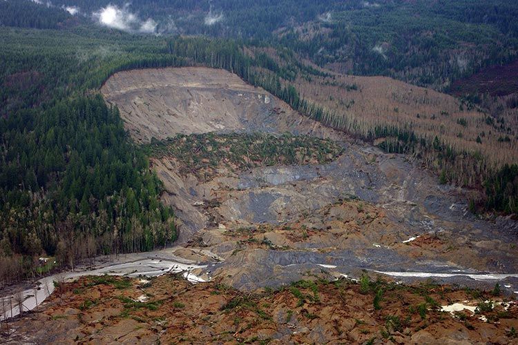
With an ever-expanding population which requires room for expansion and more resources, geologic investigations on and offshore lay the groundwork for the future. Mapping of geologic structures such as faults (on and offshore), sinkholes, landslides, and more allow us to better understand the Earth's structures and physical properties. Meanwhile, investigations into geothermal resources, permafrost, and other unique geologic features lay the groundwork for responsible resource and energy management for the 21st century and beyond.
Archaeology
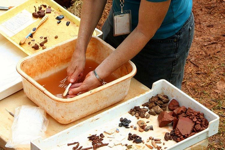
Archaeogeophysical surveys (geophysical surveys done for archaeological reasons) are increasingly being planned and commissioned for, both for small and large scale archeological investigations. Detailed surveys using geophysical methods can help supplement information from archaeological excavations or even lead to major archaeological breakthroughs. Additionally, geophysical surveys can prove useful as reconnaissance projects over large areas to quickly asses their potential for archaeological structures/artifacts.
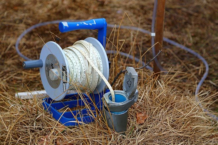
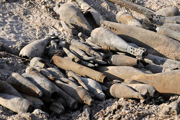
UXO Detection
UXO Detection methods are based primarily upon the concepts of Magnetometery and Time-Domain EM (TDEM) Time-domain EM. TDEM is an active technique that induces small, transient eddy currents into the ground and then measures their rate of decay. TDEM is used for a variety of applications from mining to shallow metal detection. Likewise magnetometry can be used for shallow metal detection, typically at a faster rate but less selective when it comes to discriminating UXO from scrap. Using tools such as our MagArrow UAS-Enabled Magnetometer in conjunction with our MetalMapper 2x2 allows for UXO detections to be performed most efficient and accurately. Likewise, marine and lacustrine environments can be explored for UXO using our G-882 Marine Magnetometer. With a gradiometer setup available too, UXO can be detected accurately and over large areas.
Environmental/Ground Water Studies
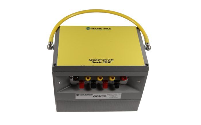
Environmental remediation efforts, groundwater/aquifer mapping, and near surface geophysical surveys for utilities are all connected, yet use a variety of different geophysical tools in order to be most competitive. Groundwater mapping can range from shallow to deep, with tools such as the Geode EM3D allowing us to see the Earth's aquifers in high detail. In order to drill to those aquifers, either for access or remediation, shallow geophysical utility surveys must be completed. Over small or large areas, magnetometers are one of the best tools of choice. A magnetometer with a gradiometer setup can very accurately detect near-surface magnetic anomalies such as a pipeline, old infrastructure, or even abandoned wells. For vast tracks of land, the MagArrow Magnetometer is the UAV-enabled magnetometer backed by the industry. For smaller areas, the G-864 Magnetometer is our latest ground magnetometer. Explore the topics below to discover how our geophysical equipment has been used in the field.
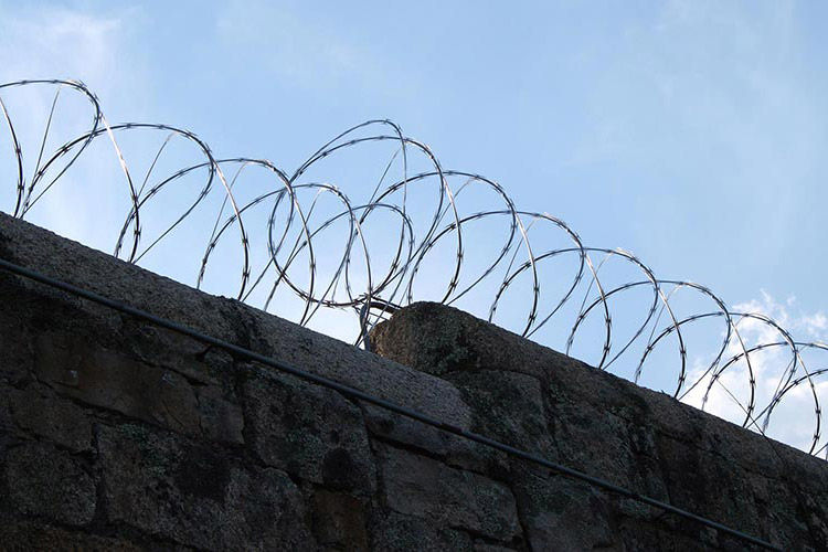
Security and Detection
Increasingly, security and detection systems are incorporating geophysical components in order to detect possible intrusions. Continuous seismic monitoring can be used to detect far-ranging above or below ground activity in seismic "quiet" areas. And larger, global seismic networks can be used for seismic risk prevention, earthquake detection, and early warning systems.
Similarly, as our use of metals and electronics increases unabated, magnetic security networks will become an integral part of security networks. Magnetometers stationed around a facility in an outside perimeter are small, easily hidden, and give clear signals to a perimeter breach if magnetically breached, such as with a moving vehicle. In the increasingly metallic, digital world we live in, it's important that the security systems of the present and future monitor and record data produced from those objects and devices that present a threat.
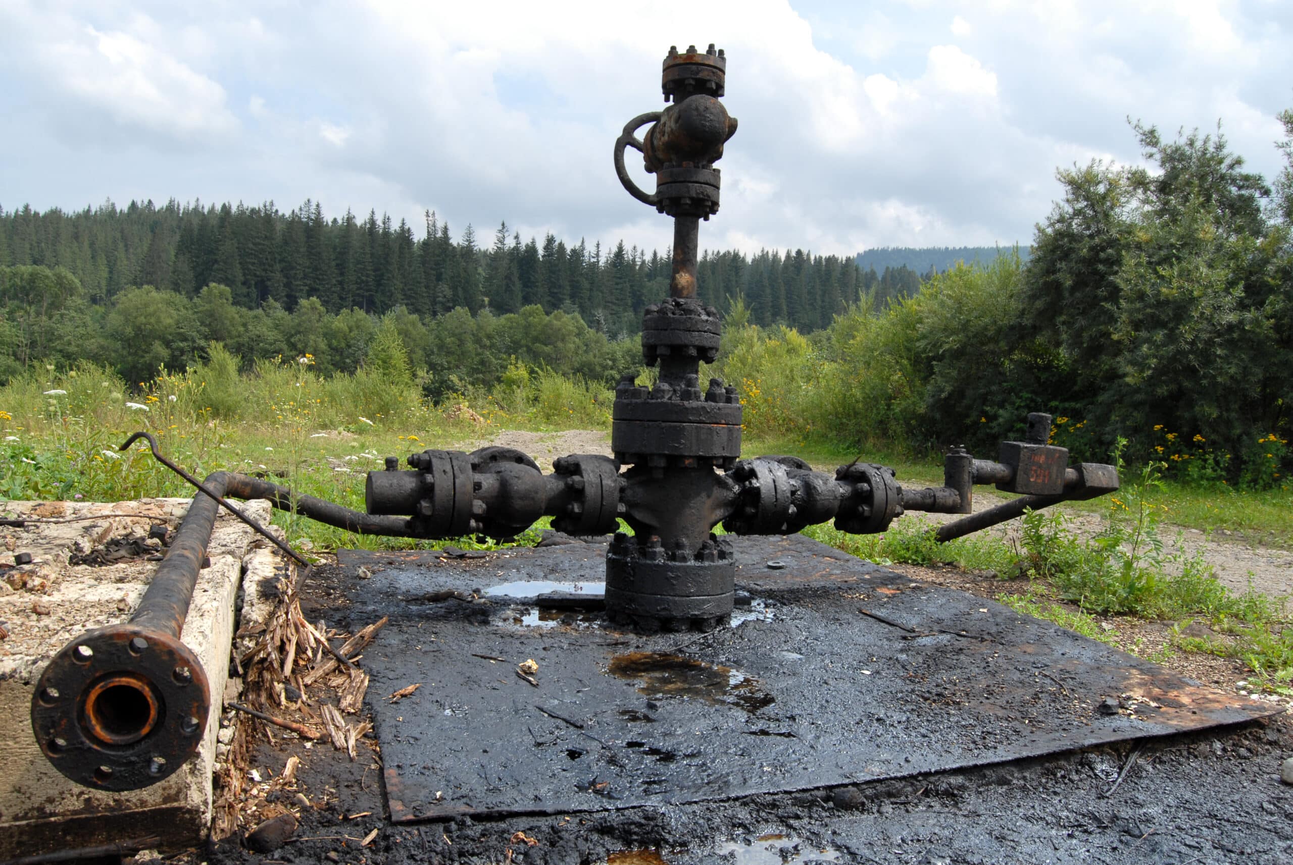
Orphaned Well Cleanup
Orphaned oil and gas wells are environmental hazards responsible not only for emitting noxious gasses like methane, but can also result in sinkhole formation and flooding. It is unclear how many orphaned wells are present in the United States, but the U.S. Department of Interior estimates somewhere between 210,000 to 746,000 located throughout the country. They also report that millions of Americans live within just one mile of an abandoned coal mine or an orphaned oil and gas well. These legacy pollution sites are environmental hazards and jeopardize public health and safety by contaminating groundwater, emitting gasses that contribute to air pollution, and littering the ground with rusted equipment. Orphaned wells are also known to contribute to sinkhole formation and flooding which can damage or destroy infrastructure.
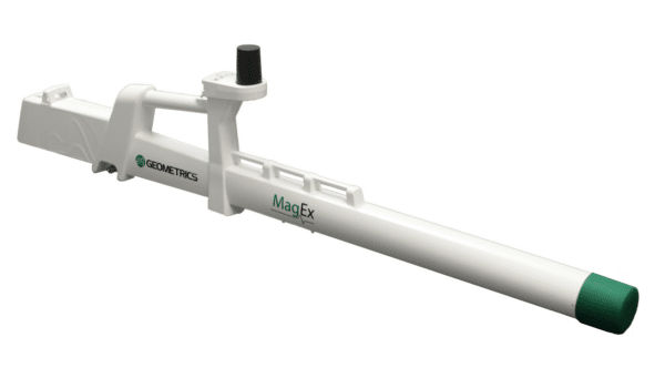
Locating these abandoned wells is the first step in mitigating the hazards these wells present. Our MagEx provides a lightweight, low-power tool for walking surveys and lets users perform ground surveys quickly and easily while viewing data in real time. For larger areas, the MagArrow II - our drone-mounted magnetometer is an ideal tool to survey large, difficult-to-access areas quickly and safely.


What we do
Products
1. Seismographs
The Best in Seismic Fidelity, from Land to Sea
- Marine Seismographs
- Land Seismographs
- Downhole Hydrophones
2. Magnetometers
Magnetometers Built to Last since 1968
- Marine Magnetometers
- Land Magnetometers
- Airborne Magnetometers
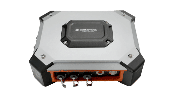
3. Geoelectrical Instruments
Geoelectric Solutions for your Biggest Questions
- Electromagnetic
- UXO Detection and Identification
4. Rentals
Geophysical Equipment Rentals & World Class Support
Please Note: The rental prices do not include transportation, custom clearance and/or training costs.
|
Seismic Equipment Rentals |
|||||
|---|---|---|---|---|---|
| Instruments | Description | One-Time Mobilization Rate | Daily Rental Rate | Weight | DIMs |
| Geode Exploration Seismograph 24-ch | 24-ch Seismograph | $200 | $100 | ||
| Geode 24-ch Seismic Survey Kit | 24-ch Seismograph w/ accessories (cables/phones) | $260 | $130 | ||
| Geode Exploration Seismograph 48-ch | 48-ch Seismograph | $400 | $200 | ||
| Geode 48-ch Seismic Survey Kit | 48-ch Seismograph w/ accessories (cables/phones) | $460 | $240 | ||
| GeoEel Solid Digital Streamer | Up to 48-ch with 6.25m group interval | Contact Us | Contact Us | ||
| MicroEel Analog Streamer | 24-ch, 3.125m group interval (requires seismograph and source) | Contact Us | Contact Us | ||
| P-Cable 3D Digital Streamer | Variable group interval | Contact Us | Contact Us | ||
| Bubble Pulser | Hegg Marine Model HMS-620 | $700 | $350 | ||
| SeisImager Software Suite* | Refraction & Surface Wave Data Analysis Software | 40 hr - $200 | 75 hr - $300 | 250 hr- | $500 |
*Note - License is for single installation only. Unused hours are not transferable to a different computer.
|
Seismic Equipment Accessories |
|||||||
|---|---|---|---|---|---|---|---|
| Instruments | Description | One-Time Mobilization Rate | Daily Rental Rate | Solo-Use One-Time Mobilization Rate | Solo-Use Daily Rental Rate | Weight | DIMs |
| HVB-1 | High Voltage Blaster | $10 | $5 | $20 | $20 | ||
| Spread Cables - 24 takeouts | 10ft, or 20ft intervals - Mueller Clips | $25 | $60 | $40 | |||
| Geophones | 4.5 Hz, 14Hz, 40Hz, vertical, Mueller Clips | $50 - 26 geophones | $26 - 26 geophones | $60 | $40 | ||
|
Magnetometer Equipment Rentals |
|||||
|---|---|---|---|---|---|
| Instruments | Description | One-Time Mobilization Rate | Daily Rental Rate | Weight | DIMs |
| MagArrow Magnetometer | UAS-Enabled Magnetometer | $365 | $395 | ||
| G-857 Magnetometer | Entry-level magnetometer | $80 | $30 | ||
| G-858 Magnetometer | High resolution magnetometer | $95 | $80 | ||
| G-858 Grad Magnetometer | High resolution magnetometer - gradiometer setup | $100 | $100 | ||
| G-859AP Magnetometer w/ GPS | Backpack Mining Magnetometer | $170 | $85 | ||
| G-864 Magnetometer | Cesium Magnetometer with Android Tablet | $150 | $130 | ||
| G-864G Magnetometer | Dual sensor version of the G-864 Cesium Magnetometer with Android Tablet | $200 | $160 | ||
| G-882 Marine Magnetometer | 200ft cable w/ depth | 240 | 120 | ||
| G-882 Marine Magnetometer | 200ft cable w/ depth & alt | 290 | 145 | ||
| G-882 TVG Marine Magnetometer System | Dual mag system w/ 400ft cable w/ depth & alt | 750 | 375 | ||
| G-823A Aerial Magnetometer | Airborne cesium magnetometer | $300 | $150 | ||
| G-824A Aerial Magnetometer | Cesium magnetometer | Contact Us | Contact Us | ||
| MagLog Lite/Pro | Magnetic logging software | $125/2-day | $450/month | ||
| Tallysman™ WAAS/EGNOS ready GPS | AP portable backpack GPS | $100 | $50 | ||
Note: G-882 includes depth transducer, logging software, 200-foot tow cable. Optional depth transducers and cable lengths are available. Minimum rental period for magnetometer systems is 7 days. Shorter duration rentals are available, but please call. G-824A Rental includes 1 copy of MagLog PRO per system.
|
Geoelectrical Equipment |
|||||
|---|---|---|---|---|---|
| Instruments | Description | One-Time Mobilization Rate | Daily Rental Rate | Weight | DIMs |
| Geode EM3D | EM Device | $580 | $375 | ||
| Stratagem EH5 | EM Device | $500 | $400 | ||
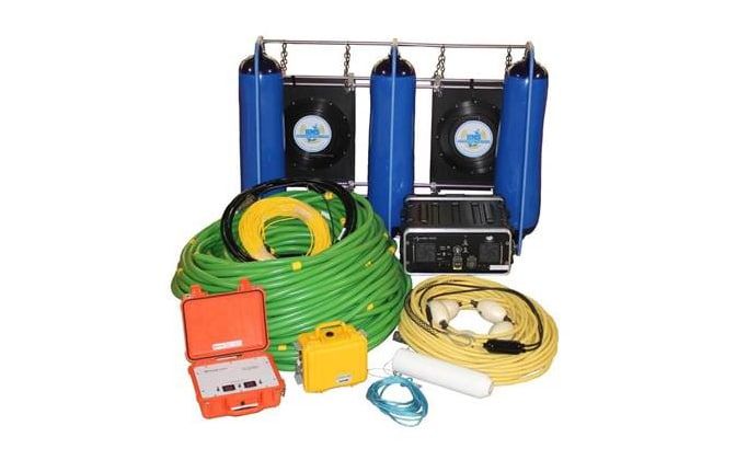
| MetalMapper 2x2 | EM Device | $1,800 | $900 | ||
| SCS2D | 2D analysis software (Zonge Geophysics) | --- | $40/day | ||