
Paragon Geophysical Services, Inc
Wichita, Kansas, United States
Paragon Geophysical Services, Inc
!


Our mission is to provide the highest resolution, most accurate seismic reflection data in the industry.
About Paragon Geophysical Services, Inc
Founded in 1993, Paragon Geophysical Services, Inc. is dedicated to the exploration of oil and natural gas and mapping of the subsurface across the continental United States.
Through advancement in technology, our mission is to provide the highest resolution, most accurate seismic reflection data in the industry.
Quality, Performance & Commitment
-
How We Achieve Excellence
- Holding ourselves to unmatched quality, performance, and workmanship at all business levels
- Enhancing client/landowner relationships and satisfaction through effective communication
- A focused responsibility to the health, safety, and trust of the people and projects we serve
- Lowering operational cost and time with the latest and most advanced recording equipment
- Preserving our natural resources and environmental impact with integrated survey support
Description of Services
Seismic Services:
1). Acquisition
Paragon Geophysical Services, Inc. offers end-to-end seismic acquisition services. Our dedication and success are focused on exploration through 2D/3D seismic. Paragon has recorded geothermal, microseismic, carbon capture storage, etc., with vibroseis and dynamite energy sources.
Our extensive experience provides a wide range of geophysical support services:
- Preplanning, hazard identification, underground utilities
- Project and HSE field management
- Dynamite coordination providing brush cutting, drilling, detonating, and plugging
2). Permitting
Permitting is a central part and excellent opportunity to build landowner and farmer relationships. Keeping tenants informed and educated of the seismic process allows for seamless field operations. We respect the permission granted and do our very best to conduct ourselves professionally and respectfully.
Permit agents are responsible for:
- Surface, mineral, state, and federal permits
- Negotiating access and right of way
- Impact and crop indemnification
- Single-point-of-contact
- Crew and landowner liaison
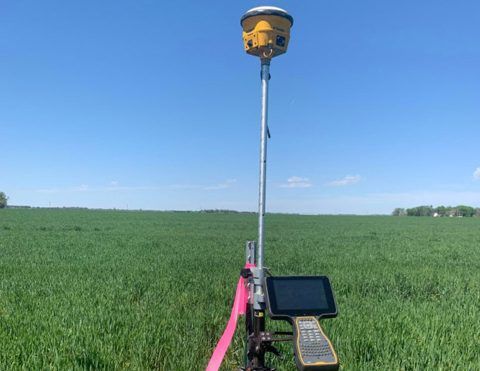
3). Surveying
Paragon Geophysical Services, Inc. provides customized survey design for target objectives.
Surveying services include:
- Collecting culture for accurate mapping (e.g., fences, pipelines, waterways, structures, etc.)
- Comprehensive fold analysis and azimuth distribution plots
- GPS and stakeless surveying
- Dynamite drilling access and locations
What we do
Equipment & Technology:
Paragon Geophysical Services, Inc. remains “A Head Above the Rest” by continuously upgrading our equipment to meet the geophysical industry’s highest standards, providing innovative recording solutions benefiting clients, landowners, and the environment.
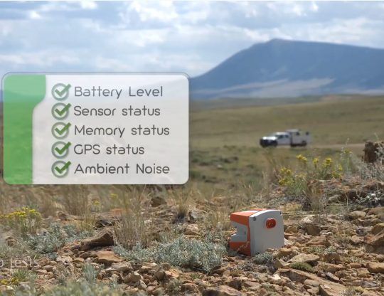
Paragon Geophysical Services, Inc. proudly presents our latest acquisition: Sercel’s most advanced, best performing, fully integrated land nodal acquisition system.
WiNG
WiNG is a wireless seismic and fully integrated nodal land acquisition system designed with a single data collection platform to manage operations more easily and efficiently. This cable-free seismic nodal solution integrates Sercel’s best performing and most sensitive broadband sensor ever, QuietSeis®, to acquire high precision seismic data. The WiNG node, or DFU (Digital Field Unit), has been designed to minimize transportation and storage costs. With its compact and light design (855g), the DFU can record seismic data for up to 50 days. An additional version, the AFU (Analog Field Unit), is also available for use with geophone strings.
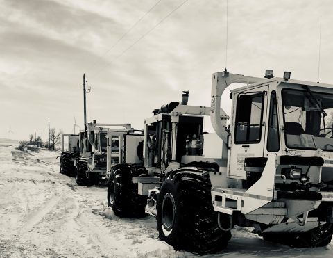
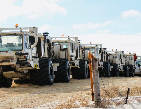
Paragon Geophysical Services Inc.’s High-Frequency Fleet
Operates the most advanced vibroseis techniques:
- GPS guidance for improved access, overcoming difficult terrain, and lessening ground impact
- Highest peak force-energy penetration
- Harmonic distortion reduction – SmartLF