Consultation - Geophysical Survey

Share
Description of Consultation
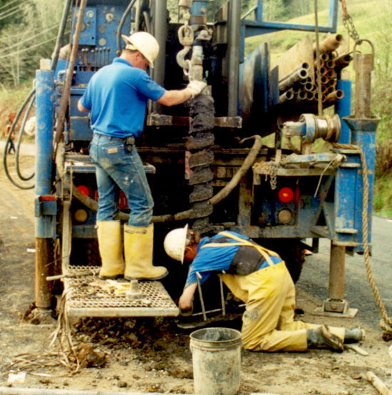
Geophysical survey is ground-based substantial sensing techniques used for subsurface imaging or mapping. Remote sensing and marine surveys are also used in oil and gas exploration, but are generally considered separate disciplines.
Other terms, such as "geophysical prospection" and "Exploration geophysics" are generally synonymous.
GCS Pakistan has qualified Employees to carry out Geophysical Investigation by using Resistivity, Seismic, Gravity, Magnetic/Electromagnetic ground & airborne surveys.
Our range of expertise in Electrical resistivity review ground water quality assessment and for cathodic safety of underground piping.
What you will get from meeting with me
Consultation - Geophysical Survey
Things I can do. Things I can offer
Consultation - Geophysical Survey
My Classification
Mining Service Company,Engineering Company,Consulting Company,Contractor,Sub-Contractor
My Experience Level
Senior
GCS Pakistan remains the major privately owned ground investigation contractor in the Pakistan, providing quality data to the construction industry. Our wealthy experience in geotechnical given that professional services such as civil works construction, investigation visit to sites for on-the-site assessment of site surroundings, grounding of the most reasonable subsoil investigation programs, laboratory testing, assessment of field data and lab test results together with static and dynamic soil/design parameters.
We also recommend on slope consistency, design of foundations (shallow or bottomless) and pavements, investigation and design of dams, Cost Estimates, credentials including viability Reports, Geotechnical Investigation Reports, Technical & Economical Proposals.
Ratings & Reviews
No Ratings & Reviews given yet..
More Consultations From Geo-Tech Consultancy Services (GCS)

Consultation - Topographical Survey

Geo-Tech Consultancy Services (GCS)
1000/hr

Consultation - Forensic Geotechnical Investigation

Geo-Tech Consultancy Services (GCS)
1000/hr

Consultation - Geotechnical Investigation Works

Geo-Tech Consultancy Services (GCS)
1000/hr
Similar Consultations (Recommended consultations)


National Engineering Services Pakistan (Pvt.) Limited (NESPAK)
1000/hr


Terra Energy & Resource Technologies, Inc
500/hr


Strata GeoResearch
500/hr


Marie Foord
150/hr


