Consultation - LAND SURVEY SOLUTIONS - GNSS SURVEYING


Share
Description of Consultation
1. PARTH 1000 iT GNSS Receiver
Features & Benefits:
- All Satellite Constellation including NavIc (IRNSS)
- CORS Enabled for GSM RTK and Post Process
- Upto 60 Degree IMU Tilt Compensation
- 965 Channel
- Adjustable Tx-Rx Internal UHF
- Inbuilt 4G modem
- Inbuilt Wi-Fi Communication
- Smart Hot-Swapable Battery
- L-Band Satellite capable GNSS Antenna
- Easy to Use
Overview
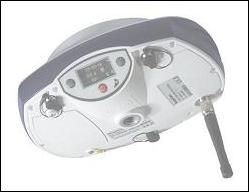
Parth1000iT is a next generation GNSS receiver Featuring the all-new 965-channel with Advanced QUANTUM Technology and IMU Enabled tilt compensation. Surveyors can capture accurate points without levelling the pole to work faster and accurate.
The Parth1000iT is optimized for tracking and processing signals from all GNSS constellations in challenging environments with Accurate Position.
The Parth1000iT offers a unique combination of integrated 4G cellular, L-band satellite capable GNSS antenna, Wi-Fi, and UHF communication.
Smart Hot swappable dual battery for longer battery life in the field you can keep working longer.
2. SP85 GNSS Receiver
Features & Benefits:
- Patented Z-Blade™ technology
- 600-channel 6G ASIC
- Hot-swappable batteries
- Internal TxRx UHF radio
- L-band satellite capable GNSS antenna
- 3.5G cellular modem
- Built-in WiFi communication
- SMS and e-mail alerts
- Anti-theft technology
- Backup RTK
- RTK bridge
- eLevel technology
- Trimble® RTX correction services
Overview
The Spectra Geospatial®SP85 is a next generation GNSS receiver that combines decades of GNSS RTK technology with revolutionary new GNSS processing. Featuring the new 600-channel “7G” chipset combined with the patented Z-Blade™ technology, the SP85 system is optimized for tracking and processing signals from all GNSS constellations in challenging environments.
With unmatched connectivity in the GNSS receiver market, the SP85 offers a unique combination of integrated 3.5G cellular, L-band satellite capable GNSS antenna, WiFi and UHF communications with SMS, email and anti-theft technology. These powerful capabilities, packaged in an ultra-rugged housing and patented antenna design, make SP85 an extremely versatile turnkey solution that can be used with unlimited operation time because of the SP85’s hot-swappable, dual battery setup.
3. SP60 GNSS Receiver
Features & Benefits:
- Extended scalability
- Z-Blade GNSS-centric technology
- 240-channel 6G ASIC
- Anti-theft technology
- Long Range Bluetooth
- Trimble CenterPoint® RTX
Overview
The SP60 is a new generation GNSS receiver offering a high level of flexibility to cover any demand from GIS all the way up to sophisticated RTK and Trimble RTX™ capable solutions.Combining the unique all-signals tracking and processing Z-Blade GNSS-centric technology and L-band capability for satellite-delivered Trimble RTX correction services, the SP60 receiver provides the most reliable measurements and the highest possible accuracy under any conditions anywhere in the world.
4. SP90m GNSS Receiver
Features & Benefits
- Most versatile, modular receiver design
- Ultra-rugged design
- Patented Z-Blade technology
- 480-channel ASIC
- Dual GNSS antenna inputs
- Event marker input
- PPS output
- OLED display, keyboard, and Web UI
- Internal TRx UHF radio
- 5G cellular modem
- Built-in Bluetooth and WiFi communication
- SMS and e-mail alerts
- Anti-theft technology
- Backup RTK
- RTK bridge
- 2 MSS L-band channels
- Trimble RTX correction services
Overview
The SP90m is a powerful, highly versatile, ultra-rugged, and reliable GNSS positioning solution for a wide variety of applications in real-time and post-processing. It also comes with a variety of integrated communications options, such as Bluetooth, WiFi, UHF radio, cellular modem, and two MSS L-band channels to receive Trimble RTX correction services.
The modular form factor of the SP90m allows for a maximum in flexibility on how the receiver can be used, such as base station, continuously operating reference station (CORS), RTK or Trimble RTX rover, on-board machine integration, vessels, etc. The ultra-rugged design of the aluminum receiver housing protects the investment, especially in tough field environments.
The state-of-the-art and patented Z-Blade GNSS-centric technology uses all available GNSS signals to deliver fast and reliable positions in real-time. Besides supporting all currently available and future planned GNSS satellite signals, the SP90m GNSS receiver allows the connection of two GNSS antennas for precise heading determination without the need for a secondary GNSS receiver.
5. SP20 Handheld GNSS Receiver
Features & Benefits
- Integrated High Accuracy GNSS
- Ergonomic Design
- Android Operating System
- Handheld accuracy
Overview
The SP20 handheld GNSS receiver combines innovative, camera- enabled data collection workflow with a high level of performance in an ergonomic, scalable solution (from meter to cm accuracy).Rugged and lightweight, the SP20 is easy-to-use and highly accurate. It is the optimal tool not only for cadastral, construction, or topo surveys, but also for a range of GIS projects, including data collection, inspection and maintenance.
The 5.3-inch screen delivers vivid visuals of the workflow, which enables precise 2D handheld logging. And the system’s high degree of accuracy can be enhanced with a monopole accessory to deliver solid, survey-grade 3D measurements. The SP20 works with Penmap for Android. A hyrbrid survey & GIS app for data collection and stake out. Whatever type of geospatial work you’re performing, turn to the easy-to-use SP20 handheld that consistently delivers highly accurate results.
What you will get from meeting with me
Consultation - LAND SURVEY SOLUTIONS - GNSS SURVEYING
Things I can do. Things I can offer
Consultation - LAND SURVEY SOLUTIONS - GNSS SURVEYING
My Classification
Energy Service Company,Mining Service Company,Engineering Company,Consulting Company,Contractor,Sub-Contractor
My Experience Level
Senior
Pan India Group, started operations in 1985, Provides Services in Oil & Gas, Mining, Geographical Management System (GSI), Remote Sensing and Photogrammetry and represents a wide spectrum of OEMs covering diverse customer base including Railways, Oil, Gas, Defence, Power, Nuclear, Space, Scientific Labs and Research organization, Public & Private Sector in India and neighbouring countries. The Group has been instrumental in bringing new technologies into India from countries like USA, Canada, UK, France, Italy, Germany , Russia and Japan backed by a complete range of start-up and support services, facilitating absorption of state-of-the-art technology. The Group today has a large pool of talent in the areas of system integration consultancy, marketing and after sales services. The group employs over 300 motivated staff.
Ratings & Reviews
No Ratings & Reviews given yet..
More Consultations From Pan India Consultants Pvt. Ltd.
Consultation - GEOINFORMATICS SOLUTIONS - GPS/DGPS based Land Survey

Pan India Consultants Pvt. Ltd.
750/hr

Consultation - GEOINFORMATICS SOLUTIONS - Photogrammetry

Pan India Consultants Pvt. Ltd.
750/hr
Consultations - GEOINFORMATICS SOLUTIONS - Remote Sensing Services

Pan India Consultants Pvt. Ltd.
750/hr

Consultation - GEOINFORMATICS SOLUTIONS - Geographical Information System (GIS)

Pan India Consultants Pvt. Ltd.
750/hr

Consultation - GEOINFORMATICS SOLUTIONS - Digital Terrain Modelling

Pan India Consultants Pvt. Ltd.
750/hr

Consultation - GEOINFORMATICS SOLUTIONS - Natural Resource Mapping & Management

Pan India Consultants Pvt. Ltd.
750/hr
Consultation - SEISMIC SOLUTIONS - MEMORY GAUGES

Pan India Consultants Pvt. Ltd.
750/hr
Consultation - SEISMIC SOLUTIONS - SOFTWARE

Pan India Consultants Pvt. Ltd.
750/hr

SEISMIC SOLUTIONS - DOWNHOLE SEISMIC TOOLS or VSP TOOLS

Pan India Consultants Pvt. Ltd.
750/hr
Similar Consultations (Recommended consultations)


Geo3Conseil
500/hr


Frederick Geosciences, LLC
1000/hr


Strata GeoResearch
500/hr


Geo3Conseil
500/hr


